Monday, March 12, 2012

Mount Kerinci (3,805 m), the highest point of Sumatra

Mount Kerinci (also spelled Kerintji, among several other ways, and referred to as Gunung Kerinci, Gadang, Berapi Kurinci, Kerinchi, Korinci, or Peak of Indrapura as well) is the highest volcano in Indonesia, and the highest peak on the island of Sumatra. It is surrounded by the lush forest of Kerinci Seblat National Park, home to the endangered species of Sumatran Tiger and Sumatran Rhinoceros.

Geography

Kerinci is more active than most Indonesian volcanoes, with nearly annual phreatic eruptions. Kerinci last erupted in 2004, and continues to spew clouds of sulphurous smoke, with plumes reaching as high as 1,000 m (3,281 ft) above the summit. While there is farmland in the area, and a tea plantation on its southern slope, Kerinci, being located in an Indonesian national park, and perhaps out of respect for its frequent growlings as well, sits in an area that is sparsely populated by Indonesian population-density standards.

Climbing

Kerinci can be climbed from the village of Kersik Tuo, 6 or 7 hours away from Padang by car or bus. The climb and descent normally takes 3 days and 2 nights, when choosing to go all the way to the summit. Climbers may also choose to go up only as far as Camp 2 or 2.5, skipping the summit attempt which is a night climb, taking 2 days and 1 night instead.

Kerinci's terrain consists of thick jungle, and can get muddy and slippery even if there are only mild drizzles, which may occur occasionally even during the dry season. To climb the volcano a guide is needed, as there have been rare cases of people disappearing after attempting to trek alone.


Lakes

The mountain has 15 lakes which the biggest are Kerinci Lake and Gunung Tujuh Lake. The 4,200-hectare of Kerinci Lake lies at a height of 650 meters, is the host of annual July Kerinci Lake Festival. While Gunung Tujuh Lake means Seven Mountains Lake which there are 7 peaks surrounding the lake. It is also the highest lake in Southeast Asia at 1,996 meters.

Kecik Wok Gedang Wok

Based on research in 1973, 'Kecik Wok Gedang Wok' people is recognized as the first tribe to settle at a plateau around Mount Kerinci 10,000 years ago. It was older than Indian Inca civilization. Today, Kecik Wong Gedang Wok people is so limited due to many of them has assimilated with Proto-Malay tribe which come later. There are around of 135 dialects uses only along the valley makes ethnography analysis is difficult to conduct.

Saturday, March 3, 2012

Gunung Rinjani (3,726 m), an active volcano on the island of Lombok

Mount Rinjani or Gunung Rinjani is an active volcano in Indonesia on the island of Lombok. Administratively the mountain is in the Regency of North Lombok, West Nusa Tenggara (Indonesian: Nusa Tenggara Barat, NTB). It rises to 3,726 metres (12,224 ft), making it the second highest volcano in Indonesia.

On the top of the volcano is a 6 km by 8.5 km caldera, which is filled partially by the crater lake known as Segara Anak (Child of the Sea). This lake is approximately 2000 metres above sea level and estimated at being around 200 metres deep; the caldera also contains hot springs.

Geography

Lombok is one of the Lesser Sunda Islands, a small archipelago which, from west to east, consists of Bali, Lombok, Sumbawa, Flores, Sumba and the Timor islands; all are located at the edge of the Australian continental shelf. Volcanoes in the area are formed due to the action of oceanic crusts and the movement of the shelf itself. Rinjani is one of at least 129 active volcanoes in Indonesia, four of which belong to the volcanoes of the Sunda Arc trench system forming part of the Pacific Ring of Fire – a section of fault lines stretching from the Western Hemisphere through Japan and South East Asia. The islands of Lombok and Sumbawa lie in the central portion of the Sunda Arc. The Sunda Arc is home to some of the world's most dangerous and explosive volcanoes. The eruption of nearby Mount Tambora on Sumbawa is known for the most violent eruption in recorded history on 15 April 1815, with a scale 7 on the VEI.

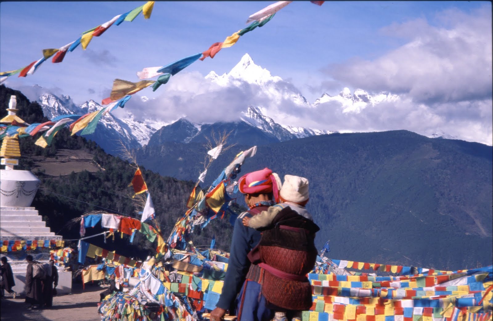
The highlands are forest clad and mostly undeveloped. The lowlands are highly cultivated. Rice, soybeans, coffee, tobacco, cotton, cinnamon, cacao, cloves, cassava, corn, coconuts, copra, bananas and vanilla are the major crops grown in the fertile soils of the island. The slopes are populated by the indigenous Sasak population. There are also some basic tourist related activities established on Rinjani primarily in or about the village of Senaru.

Rinjani volcano on the island of Lombok rises to 3,726 metres (12,224 ft), second in height among Indonesian volcanoes only to Sumatra's Kerinci volcano. Rinjani has a steep-sided conical profile when viewed from the east, but the western side of the compound volcano is truncated by the 6 x 8.5 km, oval-shaped Segara Anak caldera. The western half of the caldera contains a 230 metre-deep lake whose crescentic form results from growth of the post-caldera cone Barujari at the eastern end of the caldera.


Geologic summary

On the basis of Plate Tectonics Theory, Rinjani is one of the series of volcanoes built in the Lesser Sunda Islands due to the subduction of Indo-Australian oceanic crust beneath the Lesser Sunda Islands, and it is interpreted that the sources of melted magma is at about 165–200 km depth.

The geology and tectonic setting of Lombok (and nearby Sumbawa) are described as being in the central portion of the Sunda Arc. The oldest exposed rocks are Miocene, suggesting that subduction and volcanism began considerably later than in Java and Sumatra to the west, where there are abundant volcanic and intrusive rocks of Late Mesozoic age. The islands are located on the eastern edge of the Sunda shelf, in a zone where crustal thickness is apparently rapidly diminishing, from west to east.

The seismic velocity structure of the crust in this region is transitional between typical oceanic and continental profiles and the Mohorovičić discontinuity (Moho) appears to lie at about 20 km. These factors tend to suggest that there has been limited opportunity for crustal contamination of magmas erupted on the islands of Lombok and Sumbawa. In addition, these islands lie to the west of those parts of the eastern-most Sunda and west Banda arcs where collision with the Australian plate is apparently progressing.

The volcano of Rinjani is be located between 165 and 190 km above the Benioff Zone. There is a marked offset in the line of active volcanoes between the most easterly Sumbawa Volcano (Sangeang Api) and the line of active volcano in the Flores. This suggests that a major transcurrent fault cut across the arc between Sumbawa Island and Flores. This is considered to be a feature representing a major tectonic discontinuity between the east and west Sunda Arcs (the Sumba Fracture). Further. A marked absence of shallow and intermediate earthquake activity in the region to the south of Lombok and Sumbawa is a feature interpreted to represent a marked break in the Sunda Arc Zone. Faulting and folding caused strong deformation in the eastern part of Lombok Basin and is characterized by block faulting, shale diapirs and mud volcano.

Volcanology

The Rinjani caldera forming eruption is thought to have occurred in the 13th century. Eruption rate, eruption sites, eruptiion type and magma composition have changed during the last 10,000 years before the caldera forming eruption. The eruptions of 1994 and 1995 have presented at Gunung Baru (or 'New Mountain' - approximately 2300 metre above sea level) in the center of this caldera and lava flows from subsequent eruptions have entered the lake. This cone has since been renamed Gunung Barujari (or 'Gunung Baru Jari' in Indonesian).

The first historical eruption occurred in September 1847. The most recent eruption of Mount Rinjani was in May 2010 and the most recent significant eruptions occurred during a spate of activity from 1994 to 1995 which resulted in the further development of Gunung Barujari. Historical eruptions at Rinjani dating back to 1847 have been restricted to Barujari cone and the Rombongan dome (in 1944) and consist of moderate explosive activity and occasional lava flows that have entered Segara Anak lake. The eruptive history of Rinjani prior to 1847 is not available as the island of Lombok is in a location that remained very remote to the record keeping of the era.

On 3 November 1994, a cold lahar (volcanic mudflow) from the summit area of Rinjani volcano traveled down the Kokok Jenggak River killing thirty people from the village of Aikmel who were caught by surprise when collecting water from the river in the path of the flow.

In connection with the eruption of the cone Gunung Barujari the status for Gunung Rinjani has been raised from Normal (VEI Level 1) to 'be vigilant' (VEI Level 2) since May 2, 2009 . In May 2010 Gunung Rinjani was placed in the standby status by Center for Volcanology & Geological Hazard Mitigation, Indonesia with a recommendation that there be no activity within a radius of 4 km from the eruption at Gunung Barujari.

Volcanic composition

In Lombok, Rinjani volcano lies approximately 300 km north of the Sunda Trench (also known as Java trench) and is situated about 170 km above the active north dipping Benioff zone. Based on the composition of andesites which have very low Ni concentrations and low Mg/Mg+Fe It is suggested that the Rinjani suite is of mantle origin, but that all the andesites and dacites as well as many of the basalts have probably been modified by fractional crystallization processes. It is concluded that the Rinjani calc-alkaline suite, which in many respects is typical of many suites erupted by circum-pacific volcanoes, probably originated by partial melting of the peridotite mantle-wedge overlying the active Benioff Zone beneath Lombok Island. The Pleistocene-Recent calcalkaline suite from the active volcano, Rinjani is composed of a diverse range of lavas. These include: ankaramite, high-Al basalt, andesite, high-K andesite and dacite. Sr-isotopic and geochemical constraints suggest that this suite was derived from the sub-arc mantle. Geochemical models suggest that fractional crystallization is an important process in the suite's differentiation, although the series: ankaramite-high-Al basalt-andesite-dacite does not represent a continuously evolving spectrum of liquids.

Recent activity

Rinjani erupted three times on May 22, 2010 with activity continuing until early on May 23. According to the volcano's official monitoring agency, ash from Mount Barujari was reported as rising up to two km into the atmosphere and damaged crops. The volcano did not threaten villagers at that time. Lava flowed into the caldera lake, pushing its temperature up from 21°C to 35°C, while smoke spread 12 km.
In February 2010 observers at the Gunung Rinjani Observation Post located 12.5 km (4000 feet) NE northeast of G. Rinjani saw one whitish-colored plume that rose 100 metres (328 ft) from the volcano. Dense whitish plumes (and possibly brown) rose 500 metres (1,640 ft) - 900 metres (2,953 ft) in March 2010 on 26 occasions and as high as 1,500 metres (4,921 ft) in April 2010 on 41 occasions. Plumes seen on 1 and 2 May 2010 were "chocolate" in color and rose a maximum height of 1,600 metres (5,249 ft). From February 2010 through April 2010 seismicity decreased, although the maximum amplitude of earthquakes increased. CVGHM (Center of Volcanology and Geological Hazard Mitigation) also noted that ash eruptions and ejected incandescent material fell within Rinjani caldera, but some ash was blown out of the caldera.

The activity in early 2010 centred about Gunung Barujari a post-caldera cone that lies within the Rinjani's caldera lake of Segara Anak. The Volcanological Survey of Indonesia reported on 1 May 2010, that a column of smoke was observed rising from G. Rinjani "issuing eruptions 1300-1600 metres tall with thick brown color and strong pressure". Their report Evaluasi Kegiatan G. Rinjani of 4 May also stated that on 1 May 2010 at 10:00 four events of Explosve Earthquake were recorded with a maximum amplitude of 6–53 mm and 110 seconds long earthquake, earthquake tremor events with a maximum amplitude of 1 mm and 55 second long duration, 15 Local Tectonic earthquake events and two events of tectonic earthquake.

The Volcanic Explosivity Index (VEI) Alert Level was raised to 2 (on a scale of 1-4) on 2 May 2010. Level 1 is "Normal" and Level 2 is "Advisory" with an Aviation Alert color of Yellow-Advisory. Based on analysis of satellite imagery, the Darwin VAAC (Volcanic Ash Advisory Center) reported that on 5 May a possible ash plume from Rinjani rose to an altitude of 5.5 km (18,000 ft) a.s.l. and drifted 150 km NW. The plume was not seen in imagery about six hours later. CVGHM (Center of Volcanology and Geological Hazard Mitigation) advised the VAAC that intermittent activity could produce ash plumes to 1.5 km (5,000 ft) above the caldera.

On 27 April 2009 Gunung Barujari became active with activity continuing through to May 2009. The mountain was closed at that time as the eruptions intensified with plumes of smoke and ash as high as 8,000 m (26,250 ft). A Volcanic Explosivity Index (VEI):2 rating was issued for the activity between 2 May 2009 and 20 December 2009. The activity during this period was described as having the characteristics:of central vent eruption, flank (excentric) vent, explosive eruption and lava flow.


Previous activity

On 27 September 2004 a DVGHM (Directorate of Volcanology and Geological Hazard Mitigation) report noted the decision to increase Rinjani's hazard status to Volcanic Explosivity Index (VEI) Alert Level 2 (Yellow). During the last third of 2004, the number of volcanic and tectonic earthquakes had increased. Their increase followed a rise in the number of tectonic earthquakes that began 18 August 2004. Tremor registered on 23, 24, 25, and 26 September 2004. Tremor amplitudes ranged between 12 and 13.5 mm, and the duration of the tremor stood between 94 and 290 seconds.

In September 1995 an aviation report was issued concerning an unconfirmed ash cloud from Rinjani. A NOTAM about volcanic activity from Rinjani was issued by the Bali Flight Information Region on the morning of 12 September. An ash cloud was reportedly drifting to the south west with the cloud top around 4 km altitude.

On 3 November 1994, a cold lahar (volcanic mudflow) from the summit area of Rinjani volcano traveled down the Kokok Jenggak River killing thirty people from the village of Aikmel who were caught by surprise when collecting water from the river in the path of the flow. One person remained missing as of 9 November 1994. No damage to the village was reported. Local volcanologists noted that additional lahars could be triggered by heavy rainfall.

During 4 June 1994-January 1995 the DVGHM (Directorate of Volcanology and Geological Hazard Mitigation) noted that explosions occurred on Rinjani. Those explosions came from the Barujari volcano. At 0530 on 1 October 2004 Rinjani erupted. The eruption caused authorities to immediately raise the hazard status to Alert Level 3 (Orange). Details regarding the initial 1 October 2004 eruption are indistinct. During 2–5 October 2004 explosions sent ash columns ~300 to 800 metres above the summit. Gray, thick ash columns drifted to the north and detonation sounds accompanied every explosion. Successive explosions occurred at intervals of 5 to 160 minutes. Explosions vented on the north eastern slope of Barujari volcano. Some material also vented from Barujari's peak and fell down around its edifice. A press report in the Jakarta Post indicated that evacuations were not considered necessary. A Volcanic Explosivity Index (VEI):2 rating was issued for the activity between 1 May 2004 through to (on or after) 5 October 2004.

Between 3 June 1994 and 21 November 1994 records of Rinjani's eruptive history indicate activity accorded Volcanic Explosivity Index (VEI) with a rating of 3 with the area of activity described as Gunung Barujari. Eruptive characteristics documented for the events of that time are described as, central vent eruption with an explosive eruption, with pyroclastic flow(s), lava flow(s), fatalities and mudflow(s) (lahars).

In May 1994 a glow was noticed on the crater floor of Barujari cone, which at this time had undergone no significant activity since August 1966. A portable seismograph (PS-2) and telemetry seismograph (Teledyne) were put into operation on 27 May and 9 June, respectively. One volcanic earthquake event/day was recorded on 27, 28, 30, and 31 May. After 4 June, however, volcanic tremor with a maximum amplitude of 35 mm was recorded, presumably associated with the upward movement of magma. At 0200 on 3 June1994, Barujari cone began erupting by sending an ash plume 500 m high. One 8 June 1994 press report described emission of "smoldering lava" and "thick smoke," as well as ashfall in nearby villages from an ash cloud rising 1,500 m above the summit. Between 3 and 10 June 1994, up to 172 explosions could be heard each day from the Sembalun Lawang volcano observatory (~15 km NE). During this period, seismic data indicated a dramatic increase in the number of explosions per day, from 68 to 18,720. Eruptions were continuous at least through 19 June 1994, with maximum ash plume heights of 2,000 m on 9–11 June 1994.

Between 28 March 1966 and 8 August 1966 records of Rinjani's eruptive history indicate activity accorded a Volcanic Explosivity Index (VEI) rating of 1. Lava volume of 6.6 x 10⁶ m3 and a tephra volume of 2 x 10⁴ m3 was recorded. The area of activity described was the east side of Barujari (2250 m). Eruptive characteristics were documented as a central vent eruption, explosive eruption and lava flow(s).[42]

In December 1944 Rinjani appears to have had a significant event. Between December 25, 1944 and 1 January 1945 eruptive activity is rated 2 on the Volcanic Explosivity Index (VEI) The event has been listed in the historical records of the Global Volcanism Program indicating a lava volume: of 7.4 x 10⁷ m3 occurring in an area of activity on the north west flank of Barujari (Rombongan). The eruptive characteristics are described a central vent eruption on the flank (excentric) vent, a crater lake eruption, explosive eruption, lava flow(s) and a lava dome extrusion with associated damage to land, property.

Monitoring program

Gunung Rinjani Observation Post Rinjani Sembalun is located in the village of Lawang, Sub Sembalun 12.5 km (4000 feet) northeast of G. Rinjani) in the Regency of East Lombok. Observers at this post monitor G.Rinjani, G.Barujari/G.Tenga within the Segara Anak Caldera.


Rinjani National Park

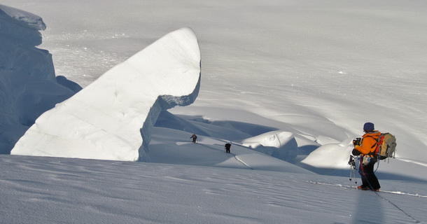
The volcano and the caldera are protected by the Gunung Rinjani National Park established in 1997. Tourism is increasingly popular with trekkers able to visit the rim, make their way into the caldera or even to make the more arduous climb to the highest point; fatalities, however, are not uncommon. In July 2009 the summit route was closed due to volcanic activity at that time and subsequently reopened when the activity decreased. During early 2010 up to and including May 2010 access to Rinjani was at times again restricted due to volcanic activity.

The park is popular for mountain climbs and trekking and represents an important nature reserve and water catchement area. The park is officially 41,330 hectares within the park boundaries and includes a further 66,000 hectares of protected forest outside. The mountain and its satellites form the Mount Rinjani National Park (Taman Nasional Gunung Rinjani) - officially 41,000 hectares within the park boundaries and a further 66,000 hectares of protected forest outside. In 2008, the Indonesian government proposed to UNESCO that Mount Rinjani be one of the world's official geoparks. If this was approved by UNESCO, Mount Rinjani would become the first such geological park in Indonesia.

It has been claimed that the preliminary documentation required for UNESCO registration has not received sufficient support from the Nusa Teggara Barat government offices. Among the requirements to become a geo-park sufficient information must be supplied to show that the location has sufficient and appropriate management, information services, access to educational instruction to facilitate "knowledge-based geotourism", the implementation of a sustainable regional economy, biodiversity conservation, and to have established public access to the park area.

Mount Rinjani has obtained the World Legacy Award from Conservation International and Traveller (2004), and was a finalist for Tourism for Tomorrow Awards (2005 dan 2008) from the World Travel Tourism Council (WTTC).

Eruption history of Rinjani

VEI Date Start-Stop Lava Volume Tephra Volume Area of Activity Eruptive Characteristics Note
2 2010 February
2010 May 23


Gunung Barujari Smoke Plumes ash eruptions ejected incandescent material
fell within Rinjani caldera

some ash was blown out of the caldera
possible ash plume rose to an altitude of 5.5 km
further ash plumes to 2km, lava flows, crop damage
SI / USGS Weekly Volcanic Activity Report-Rinjani
PVMGV-Evaluasi Kegiatan G. Rinjani ABC Asia Pacific News Service 24 may2010
2 2009 May 2
2009 Dec 20 (?)


NE flank of Gunung Barujari Central vent eruption Flank (excentric) vent Explosive eruption Lava flow(s) Historical Records
GVP-Rinjani
2 2004 Oct 1
2004 Oct 5
(on or after)


Summit and NE flank of Gunung Barujari Central vent eruption Central vent eruption Flank (excentric) vent Explosive eruption Historical Records
GVP-Rinjani
0 1995 Sep 12


Explosive eruption (?) Historical Records
GVP-Rinjani
Eruption "Uncertain"
3? 1994 Jun 3
1994 Nov 2


Gunung Barujar Central vent eruption Explosive eruption Pyroclastic flow(s) Lava flow(s) Fatalities Mudflow(s) (lahars) Historical Records
GVP-Rinjani
(VEI): 3
1 1966 Mar 28
1966 Aug 8
6.6 x 10⁶ m³ 2 x 10⁴ m³ Eastern side of Gunung Barujari (2250 m) Central vent eruption Explosive eruption Lava flow(s) Historical Records
GVP-Rinjani
0? 1965 Sep
(end) Unknown


Gunung Barujari Flank (excentric) vent eruption
Lava flow(s)
Historical Records
GVP-Rinjani
0? 1953 Oct 15
± 45 days
(end) Unknown


Gunung Barujari Central vent eruption Historical Records
GVP-Rinjani
(VEI): 0?
0? 1949
1950 (months uncertain)


NW flank of Gunung Barujari Central vent eruption Explosive eruption Lava flow(s) Historical Records
GVP-Rinjani
2 1944 Dec 25
1945 Jan 1 (?)
7.4 x 10⁷ m³
NW flank of Barujari (Rombongan) Central vent eruption Flank (excentric) vent Crater lake eruption Explosive eruption Lava flow(s) Lava dome extrusion Damage (land, property, etc.) Historical Records
GVP-Rinjani
0 1941 May 30
(end) Unknown


Rinjani summit Central vent eruption Historical Records
GVP-Rinjani
Eruption is Uncertain
2 1915 Nov 4
(end) Unknown


Gunung Barujari
(Segara Munjar)
Central vent eruption Explosive eruption Historical Records
GVP-Rinjani
2 1909 Nov 30
1909 Dec 2


Gunung Barujari Central vent eruption Explosive eruption
Mudflow(s) (lahars)
Historical Records
GVP-Rinjani
1 1906 Apr 29
(end) Unknown


Gunung Barujari Central vent eruption Explosive eruption Historical Records
GVP-Rinjani
2 1901 Jun 1
1901 Jun 2


Gunung Barujari Central vent eruption Explosive eruption Historical Records
GVP-Rinjani
2 1900 Nov 30
1900 Dec 2


Gunung Barujari Central vent eruption Explosive eruption Lava flow(s) Historical Records
GVP-Rinjani
2 1884 Aug 8
1884 Aug 10
± 1 day


Gunung Barujari Central vent eruption Explosive eruption Historical Records
GVP-Rinjani
2 1847 Sep 10
1847 Sep 12


Gunung Barujari Central vent eruption Explosive eruption Historical Records
GVP-Rinjani
n/a 13th century (?)
exact date unknown


Gunung Rinjani Possible caldera forming eruption Speculative date
Refer to scientific literature


Monday, February 6, 2012

Mount Doi Inthanon (2,565 m), the highest peak in Thailand

Doi Inthanon is the highest mountain in Thailand. It is located in Mae Chaem District, Chiang Mai Province. The mountain was also known in the past as Doi Luang (meaning big mountain) or Doi Ang Ka, meaning the crow's pond top. Near the mountain's base was a pond where many crows gathered. The name Doi Inthanon was given in honour of the king Inthawichayanon, one of the last kings of Chiang Mai, who was concerned about the forests in the north and tried to preserve them. He ordered that after his death his remains shall be placed at Doi Luang, which was then renamed.

Today, the summit of Doi Inthanon is a popular tourist destination for both foreign and Thai tourists, with a peak of 12,000+ visitors visiting the summit on New Year's Day. In addition to a range of tourist facilities on the summit, there is also a Royal Thai Air Force weather radar antenna on the summit.


Geography

Doi Inthanon is part of the Thanon Thong Chai Range, a mountain range of the Thai highlands stretching southwards from the Daen Lao Range. This range, the southwesternmost of the Shan Highland system, separates the Salween watershed from the Mekong watershed. Other high peaks of the Loi Lar Mountain Range are Doi Luang Chiang Dao (2,175 m), Doi Pui (1,685 m), and Doi Suthep (1,601 m).

In 1954, the forests around Doi Inthanon were preserved, creating Doi Inthanon National Park, as one of the original 14 National parks of Thailand. This park now covers 482.40 km² and spreads from the lowlands at 800 m altitude up to the peak at 2565 m. The summit experiences average year-round temperatures in the low to mid teens (Celsius) and high humidity. It is not uncommon for the temperature to drop below zero during the winter months. Given the varied climatic and ecological areas regions, the park supports a range of animal species including over 360 bird species.

On the lower slope of Doi Inthanon, near the Karen hill tribe village Ban Sop Had, are the Wachirathan waterfalls, where the Wachirathan tumbles over a granite escarpment.


Napamaytanidol Chedi

On the main road to the summit of Doi Inthanon stand the two Napamaytanidol Chedi. These temples were built to honour the 60th birthday of the King and Queen in 1987 and 1992 respectively.

Geology

Geologically the mountain is a granite batholith in a north-south oriented mountain range. The second-highest peak of this range is Doi Hua Mod Luang at 2,340 m.

Monday, January 23, 2012

Mount Apo (2,954 m), the highest point in the Philippines

Mount Apo - Philippines' Highest Peak
Mount Apo is a large solfataric, potentially-active stratovolcano in the island of Mindanao, Philippines. With an altitude of 2,954 metres (9,692 ft), it is the highest mountain in the country and is located between Davao City and Davao del Sur province in Region XI and Cotabato province in Region XII. The peak overlooks Davao City 40 kilometres (25 mi) to the northeast, Digos City 25 kilometres (16 mi) to the southeast, and Kidapawan City 20 kilometres (12 mi) to the west.

Apo, which means "ancestor", is flat-topped mountain with three peaks and is capped by a 500-metre-wide (1,600 ft) volcanic crater containing a small crater lake. The date of its most recent eruption is unknown, and none are verified in historical times.

The volcano is one of the most popular climbing destinations in the Philippines with the summit, on the average, takes two days to reach. The first recorded climb was on October 10, 1880, by a party led by Joaquin Rajal, then Spanish governor of Davao.

Conservation

Mount Apo Natural Park

On May 9, 1936, Mount Apo was declared a national park with Proclamation no. 59 by President Manuel L. Quezon, followed by Proclamation no. 35 of May 8, 1966 then Proclamation no. 882 of September 24, 1996. On February 3, 2004, the approval of Republic Act no. 9237 established Mount Apo as a protected area under the category of natural park with an area of 54,974.87 hectares (135,845.9 acres); with two peripheral areas of 2,571.73 hectares (6,354.9 acres) and 6,506.40 hectares (16,077.7 acres) as buffer zones, provided for its management and for other purposes.

Although a declared a Natural Park, the current climbing trails are littered with rubbish by irresponsible climbers, opening paths for soil erosion across the already denuded mountain sides. Some mountain and social climbing groups conduct climbs after the Holy Week/Easter, the peak climbing season, to clean the affected areas.


UNESCO World Heritage list

The Department of Environment and Natural Resources (DENR) submitted Mount Apo on December 12, 2009 for inclusion in the UNESCO world heritage list. The mountain is considered by DENR as the center of endemism in Mindanao. It has one of the highest land-based biological diversity in terms of flora and fauna per unit area. It has three distinct forest formations, from lowland tropical rainforest, to mid-mountain forests, and finally to high mountain forests.

A portion of the eastern slopes are also within the scope of the UNESCO Hydrology Environment Life and Policy (HELP) Network. The Davao HELP Network is focused on building collaboration among watershed stakeholders.

Flora and Fauna

The mountain is home to over 272 bird species, 111 of which are endemic to the area. It is also home to one of the world's largest eagles, the Philippine Eagle, which is the country’s national bird.

Fruits like durian, the king of fruits, grow abundantly in Mt. Apo.


Geothermal energy

Mount Apo is an excellent source of geothermal energy. Located in Barangay Ilomavis, Kidapawan City, North Cotabato is the Mindanao Geothermal Production Field with a power output of 106 MW, currently the only power plant of its kind in Mindanao.

The Philippine National Oil Company geothermal plant supplies electricity to Kidapawan and its neighboring provinces, its completion boosted the city's economy.

Indigenous peoples

Six indigenous peoples - Manobos, Bagobo, Ubos, Atas, K’Iagans and the Tagacaolo consider Mt. Apo as their ancestral domain and their home. These tribes have lived since time immemorial, around the mountain that they also consider as sacred ground, their place of worship and burial ground of Apo Sandawa, their great forefather. A number of genealogies of known Lumad leaders in South Central Mindanao trace their roots to Mt. Apo. For the Lumads, the term Apo was coined from the name of their great grandparent Apo Sandawa. Mt. Apo is the source of their continual supply of food and medicine, their spiritual and cultural way of life.

Hiking activity

At 2,954 meters (9,692 ft), Mount Apo is the highest mountain in the Philippines. This majestic peak is one of the country's most popular climbing destinations.

Several trails lead to the summit, coming from North Cotabato and Davao provinces. Arguably the easiest route to the National Park is through Kidapawan City with an average hike taking 3–4 days roundtrip. In the classification system used by local popular mountaineering website PinoyMountaineer.com, the difficulty of the hike is 7 out of 9. Various sights along the trail include Lake Venado, one of the highest lakes in the Philippines, the solfataras and the old crater near its summit. The mountain may be climbed year-round or one can register and join the city's Summer Climb or the Annual October Trek / Climb.

Mount Ramelau (2,963 m), the highest mountain in East Timor

Tatamailau (Tetum: Foho Tatamailau), sometimes referred as Mount Ramelau, is the highest mountain in East Timor and also of Timor island at 2,963 m (9,721 ft). The mountain is located approximately 70 km (43 mi) of the capital Dili in the district of Ainaro. In Portuguese colonial days it was considered the highest mountain of Portugal, and indeed of the whole Portuguese colonial empire, since the highest mountain of Portugal is of a more modest height. The name "Tatamailau" is Mambai-origin, the local language and means "Grandfather of all". "Ramelau" is the name of the massif of the mountain. The Tatamailau is dedicated to the Virgin Mary and the subject of an annual pilgrimage commemorating the Annunciation of the Blessed Virgin Mary, on or around March 25. There is a three meter high statue of the Virgin Mary on the peak, which came from Italy and was erected during the Indonesian rule in 1997.

Tatamailau can be climbed from the town of Hato Bulico 3 km (1.9 mi) to the northeast or from the village of Aimeta 6 km (3.7 mi) to the north; there is about 910 m (2,990 ft) of climbing from either. The track from Hato Bulico to the summit is very well formed having originally been cut to create a pilgrimage trail to the Virgin Mary figure on the summit and was once negotiable by four wheel drive vehicle. A map is not required once on the track. The track is now very severely degraded with massive washouts requiring major detours to negotiate. Because the track was cut for vehicular access the constant gradient is monotonous, the poor engineering has caused major environmental damage and the route affords few views of note. The route from Aimeta is via a network of goat herders' tracks, it does not appear on current maps and a local guide is needed. However, the Aimeta track is varied, traverses unspoilt country, is extremely interesting with many unfolding mountain views and consequently presents by far the most enjoyable climb. A fit person should allow four hours from Hato Bulico to the summit, six hours from Aimeta, nine hours from Aimeta to Hato Bulico. Assume no water is available en route. There is no human habitation above Hato Bulico or Aimeta. It is possible to camp on the saddle below the summit in the dry season and experience the sunset and sunrise from the same location. The summit can freeze in the dry season; in the wet season the summit can be sufficiently cold, wet and windy to pose a risk of hypothermia.


Hato Bulico is a 1½ - 2 hour drive from Maubisse on a sealed road but requires a four wheel drive. In the wet season it can be dangerous and periodically impassable but never for long. There is an excellent resting place at Hato Bulico close to the start of the track.

Aimeta can be reached from Letefoho in about 1½ hours. Shelter, but not food, may be negotiated at Aimeta with local assistance but it is advisable to arrive entirely self sufficient. The nearest accommodation is at the Saint Bakhita, Eraulo, via Vila Ermera and an excellent, easy walk is to be had from there to Aimeta in about four hours. Horses for baggage can be hired at Aimeta and this is useful if camping on the summit or to assist stragglers. Aimeta can be a logistical challenge, which is why almost all summit bids are launched from Hato Bulico but it is possible, with care, for supporting transport to drive from Aimeta directly to Hato Bulico if the road is navigable otherwise, in the Wet season, via Gleno and Aileu in about five hours. An ideal route is to do the summit from Aimeta to Hato Bulico taking in both sides of the mountain; local assistance is essential for those without fluent Tetum and local knowledge.

Sunday, January 22, 2012

Mount Kinabalu (4,093 m) the highest mountain of Malaysia and Borneo

Mountain Kinabalu
Mount Kinabalu (Malay: Gunung Kinabalu) is a prominent mountain on the island of Borneo in Southeast Asia. It is located in the East Malaysian state of Sabah and is protected as Kinabalu National Park, a World Heritage Site. Kinabalu is the tallest peak in Borneo's Crocker Range and is the tallest mountain in the Malay Archipelago. Mount Kinabalu is also the 20th most prominent mountain in the world by topographic prominence.

In 1997, a re-survey using satellite technology established its summit (known as Low’s Peak) height at 4,095 metres (13,435 ft) above sea level, which is some 6 metres (20 ft) less than the previously thought and hitherto published figure of 4,101 metres (13,455 ft).

Mount Kinabalu includes the Kinabalu montane alpine meadows ecoregion in the montane grasslands and shrublands biome. The mountain and its surroundings are among the most important biological sites in the world, with over 4500 species of plant, 326 species of birds, and 100 mammalian species identified. Among this rich collection of wildlife are famous species such as the gigantic Rafflesia plants and the orangutan. Mount Kinabalu has been accorded UNESCO World Heritage status.

Low's Peak can be climbed quite easily by a person in good physical condition and there is no need for mountaineering equipment at any point on the main route. Other peaks along the massif, however, require rock climbing skills.

Biology

Significantly, Mount Kinabalu along with other upland areas of the Crocker Range is well-known worldwide for its tremendous botanical and biological species biodiversity with plants of Himalayan, Australasian, and Indomalayan origin. A recent botanical survey of the mountain estimated a staggering 5,000 to 6,000 plant species (excluding mosses and liverworts but including ferns), which is more than all of Europe and North America (excluding tropical regions of Mexico) combined. It is therefore one of the world's most important biological sites.

Large lower pitcher of Nepenthes rajah

Flora

The flora covers the mountain in zones of different types of habitat as one climbs up, beginning with a lowland belt of fig trees and insectivorous pitcher plants. Then between 2,600 to 3,200 m (8,530 to 10,499 ft) is a layer of short trees such the conifer Dacrydium gibbsiae and dwarf shrubs, mosses, lichens, liverworts, and ferns. Finally many of the world's richest variety of orchids are found on the high rockier slopes.

These plants have high levels of endemism (i.e. species which are found only within Kinabalu Park and are not found anywhere else in the world). The orchids are the best-known example with over 800 species including some of the highly-valued Paphiopedilum slipper orchids, but there are also over 600 species of ferns (more than the whole of Africa’s 500 species) of which 50 are found nowhere else, and the richest collection in the world for the Nepenthes pitcher plants (five of the thirteen are found nowhere else on earth) which reach spectacular proportions (the largest-pitchered in the world being the endemic Nepenthes rajah). The parasitic Rafflesia plant, which has the largest single flower in the world, is also found in Kinabalu (particularly Rafflesia keithii whose flower grows to 94 centimetres (37 in) in diameter), though it should be noted that blooms of the flower are rare and difficult to find. Meanwhile another Rafflesia species, Rafflesia tengku-adlinii, can be found on the neighbouring Mount Trus Madi and the nearby Maliau Basin.

Its incredible biodiversity in plant life is due to a combination of several unique factors: its setting in one of the richest plant regions of the world (the tropical biogeographical region known as western Malesia which comprises the island of Sumatra, the Malay Peninsula, and the island of Borneo), the fact that the mountain covers a wide climatic range from near sea level to freezing ground conditions near the summit, the jagged terrain and diversity of rocks and soils, the high levels of rainfall (averaging about 2,700 millimetres (110 in) a year at park HQ), and the climatic instability caused by periods of glaciation and catastrophic droughts which result in evolution and speciation. This diversity is greatest in the lowland regions (consisting of lowland dipterocarp forests, so called because the tree family Dipterocarpaceae are dominant). However, most of Kinabalu’s endemic species are found in the mountain forests, particularly on ultramafic soils (i.e. soils which are low in phosphates and high in iron and metals poisonous to many plants; this high toxic content gave rise to the development of distinctive plant species found nowhere else).

A mountain squirrel, probably Sundasciurus tenuis, from Mount Kinabalu

Fauna

The variety of plant life is also habitat for a great variety of birds and animals. There are some 326 species of birds in Kinabalu Park, including the spectacular Rhinoceros Hornbill, Mountain Serpent-eagle, Dulit Frogmouth, Eyebrowed Jungle Flycatcher, and Bare-headed Laughingthrush. Twenty-four birds are mainly found on the mountain and one, the Bornean Spiderhunter, is a pure endemic. The mountain is home to some 100 mammalian species mostly living high in th trees, including one of the four great apes, the orangutan (though sightings of these are uncommon; estimates of its numbers in the park range from 25 to 120). Other mammals include three kinds of deer, the Malayan Weasel (Mustela nudipes), Oriental Small-clawed Otter (Aonyx cinerea), and Leopard Cat (Felis bengalensis). Endemic mammals include the Black Shrew (Suncus ater) and Bornean Ferret-badger (Melogale everetti).

Endemic annelids number less than a dozen known species but include the Kinabalu giant red leech that preys on various earthworms, including the Kinabalu giant earthworm.

Threats and preservation

The steep mountainsides with poor soil are not suitable for farming or for the timber industry so the habitats and animal life of Kinabalu remain largely intact, with about a third of the original habitat now degraded. Kinabalu Park was established in 1964 and the nearby mountains were protected as the Crocker Range National Park in 1984. However even national park status does not guarantee full protection, as logging permits were granted on Trus Madi in 1984.

Summit of Mount Kinabalu

Geology

Mount Kinabalu is essentially a massive pluton formed from granodiorite which is intrusive into sedimentary and ultrabasic rocks, and forms the central part, or core, of the Kinabalu massif. The granodiorite is intrusive into strongly folded strata, probably of Eocene to Miocene age, and associated ultrabasic and basic igneous rocks. It was pushed up from the earth’s crust as molten rock millions of years ago. In geological terms, it is a very young mountain as the granodiorite cooled and hardened only about 10 million years ago. The present landform is considered to be a mid-Pliocene peneplain, arched and deeply dissected, through which the Kinabalu granodiorite body has risen in isostatic adjustment. It is still pushing up at the rate of 5 mm per annum. During the Pleistocene Epoch of about 100,000 years ago, the massive mountain was covered by huge sheets of ice and glaciers which flowed down its slopes, scouring its surface in the process and creating the 1,800 metres (5,900 ft) deep Low's Gully (named after Hugh Low) on its north side. Its granite composition and the glacial formative processes are readily apparent when viewing its craggy rocky peaks.

History

British colonial administrator Hugh Low made the first recorded ascent of Mount Kinabalu's summit plateau in March 1851. Low did not scale the mountain's highest peak, however, considering it "inaccessible to any but winged animals". In April and July 1858, Low was accompanied on two further ascents by Spenser St. John, the British Consul in Brunei. The highest point of Mount Kinabalu was finally reached in 1888 by zoologist John Whitehead. British botanist Lilian Gibbs became the first woman and the first botanist to summit Mount Kinabalu in February 1910.

Botanist E. J. H. Corner led two important expeditions of the Royal Society of Great Britain to the mountain in 1961 and 1964. Kinabalu National Park was established in 1964. The park was designated a natural World Heritage Site in 2000.


Climbing route

Climbers must be accompanied by accredited guides at all times due to national park regulations. There are two main starting points for the climb: the Timpohon Gate (located 5.5 km from Kinabalu Park Headquarters, at an altitude of 1,866 metres (6,122 ft)), and the Mesilau Nature Resort. The latter starting point is slightly higher in elevation, but crosses a ridge, adding about two kilometres to the ascent and making the total elevation gain slightly higher. The two trails meet about two kilometres before Laban Rata.

Accommodation is available inside the park or outside near the headquarters. Sabah Parks has privatized Mount Kinabalu activities to an organization called Sutera Sanctuary Lodges (also known as Sutera Harbour). The mountain may be climbed on a single day drip, or hikers may (usually) stay one night at Laban Rata Resthouse at 3,270 metres (10,730 ft) in order to complete the climb in 2 days, finishing the ascent and descending on the second day. The majority of climbers begin the ascent on day one of a two day hike from Timpohon gate at 1,866 metres (6,122 ft), reaching this location either by minibus or by walking, and then walk to Laban Rata. Most people accomplish this part of the climb in 3 to 6 hours. Since there are no roads, the supplies for the Laban Rata Resthouse are carried by porters, who bring up to 30 kilograms of supplies on their backs. Hot food and beverages, hot showers and heated rooms are available at Laban Rata. The last 2 kilometres (6,600 ft), from the Laban Rata Resthouse at 3,270 metres (10,730 ft) to Low's Peak (summit) at 4,095.2 metres (13,436 ft), takes between 2 and 4 hours. The last part of the climb is on naked granite rock.

Given the high altitude, some people may suffer from altitude sickness and should return immediately to the bottom of the mountain, as breathing and any further movement becomes increasingly difficult.

Tales

There are two stories that led to the main beliefs in the origin of the mountain's name.

The first derivation of the word Kinabalu is extracted from the short form for the Kadazan Dusun word 'Aki Nabalu', meaning "the revered place of the dead".

The second source states that the name "Kinabalu" actually means "Cina Balu" (which would fully mean "A Chinese Widow"). Due to the lingual influence among the Kadazan Dusun of Sabah, the pronunciation for the word "cina" (chee-na) was changed to "Kina" (kee-na).

It was told that a Chinese prince, was cast away to Borneo when his ship sank in the middle of the South China Sea. He was subsequently rescued by the natives from a nearby village. As he recovered, he was slowly accepted as one of the people of the village. Eventually, he fell in love with a local woman, and married her. Years went by, and he started to feel homesick. So he asked permission from his newly-found family to go back to China to visit his parents (the Emperor and Empress of China). To his wife, he promised that as soon as he was done with his family duties in China, he would come back to Borneo to take her and their children back to China.

When he made his return to China, he was given a grand welcome by his family. However, to his dismay, his parents disagreed with him about taking his Bornean wife back to China. Worse, they told him that he was already betrothed to a princess of a neighbouring kingdom. Having no choice (due to high respect towards his parents), he obeyed with a heavy heart.

Meanwhile, back in Borneo, his wife grew more and more anxious. Eventually, she decided that she will wait for her husband's ship. However, since the village was situated far away from the coast, she couldn't afford to come to the shore and wait for him daily. Instead she decided to climb to the top of the highest mountain near her village, so that she could have a better view of the ships sailing in the South China Sea. Thus, she was then seen climbing up the mountain at every sunrise, returning only at night to attend to her growing children.

Eventually her efforts took their toll. She fell ill, and died at the top of the cold mountain while waiting for her husband. The spirit of the mountain, having observed her for years, was extremely touched by her loyalty towards her husband. Out of admiration for this woman, the spirit of the mountain turned her into a stone. Her face was made to face the South China Sea, so that she could wait forever for her dear husband's return.

The people in her hometown who heard about this were also gravely touched by this. Thus, they decided to name the mountain "Kinabalu" in remembrance of her. To them, the mountain is a symbol of the everlasting love and loyalty that should be taken as a good example by women.

Local legend among the people of Ranau, a district in Sabah, has it that St. John's Peak was the stone which her body was turned into.

A panoramic view from the summit of Mount Kinabalu

Friday, January 20, 2012

Hkakabo Razi (5,881 m), the highest peak in Myanmar and South East Asia

Hkakabo Razi is Southeast Asia's highest mountain, located in the northern Myanmar state of Kachin. It lies in an outlying subrange of the Greater Himalayan mountain system. The mountain lies on the border tri-point among Myanmar, China, and India.

The peak is enclosed within Hkakabo Razi National Park. The park is entirely mountainous and is characterized by broad-leaved evergreen rain forest, a sub-tropical temperate zone from 2,438 to 2,743 metres (7,999–8,999 ft), then broad-leaved, semi-deciduous forest and finally needle-leaved evergreen, snow forest. Above 3,353 metres (11,001 ft), the highest forest zone is alpine, different not only in kind from the forest, but different in history and origin. Still higher up, around 4,572 metres (15,000 ft), cold, barren, windswept terrain and permanent snow and glaciers dominate. At around 5,334 metres (17,500 ft), there is a large ice cap with several outlet glaciers.

Environmental protection

Hkakabo Razi was established as a natural reserve on January 30, 1996 and as a national park on November 10, 1998. The Khakaborazi National Park is the last stronghold for biodiversity in Myanmar. Extraordinarily rich flora and fauna, ranging from lowland tropical to alpine species still await proper research and identification. They have barely been studied, and the park remains an excellent center for field study for students of botany, geology, zoology and geography. A study was done by the Forest Department with the assistance of Wildlife Conservation Society of New York during 1997 and 1998. The results have been presented in ICIMOD sponsored Workshop “Sub-regional Consultation on Conservation of Hkakabo Razi Mountain Ecosystems in Eastern Himalayas”, held in Putao, Myanmar during 25–29 October 1999. This was followed in 2001 with an international, interdisciplinary team of scientists from the California Academy of Sciences in San Francisco, National Geographic Society, Harvard University, the Chinese Academy of Sciences, and the Myanmar Forestry Ministry. On 11 September 2001, herpetologist Joseph Slowinski, team leader from California Academy of Sciences, was bitten by a venoumous krait and died in the field. In 2002-2003, P. Christiaan Klieger, anthropologist from California Academy of Sciences and photographer Dong Lin retraced their previous steps, and succeeded in making the first anthropological survey of the Hkakabo Razi region. On foot they reached the northern-most village in Myanmar , Tahaundam, which is inhabited by about 200 Khampa Tibetans, including mountaineer Nyama Gyaltsen.

The region will shortly be opened to the general public through eco-tourism by the Myanmar authorities. The government is collecting information for development in that regard and a number of scientific expeditions have been already accepted in the region.

Only a few Westerners ever made it to Mt. Hkakabo Razi, the National Park or anywhere close to it. Historically, Lord Cranbrook and Richard Kaulback probably have been the first westeners to walk through the Alung Dung valley.


Climbing information

Takashi Ozaki (Japan, 1951-May 14, 2011) and Nyima Gyaltsen (aka "Aung Tse"; Burma) made the first ascent in 1996. Ozaki had attempted the mountain in 1995 but was turned back due to bad weather. Ozaki died May 14, 2011 while attempting to summit Mt. Everest. The route to basecamp is long (four weeks) and arduous through dense rain forest with many unbridged stream crossings. The recent first ascent can also be attributed to the policy that foreigners were not allowed into the area until 1993.

 
Design by | Bloggerized by World Mountain - Premium Blogger Themes | Blogger Templates