Showing posts with label Seven Summits. Show all posts

Tuesday, June 21, 2011

Climbing of Aconcagua

In mountaineering terms, Aconcagua is technically an easy mountain if approached from the north, via the normal route. Aconcagua is arguably the tallest non-technical mountain in the world, since the northern route does not absolutely require ropes, axes, and pins. Although the effects of altitude are severe (atmospheric pressure is 40% of sea-level at the summit), the use of supplemental oxygen is not required. Altitude sickness will affect most climbers to some extent, depending on the degree of acclimatization.

The second most frequented route is the Polish Glacier Traverse route, also known as the "Falso de los Polacos" route. This approaches the mountain through the Vacas valley, ascends to the base of the Polish Glacier, then traverses across to the normal route for the final ascent to the summit. The third most popular route is the Polish Glacier itself.

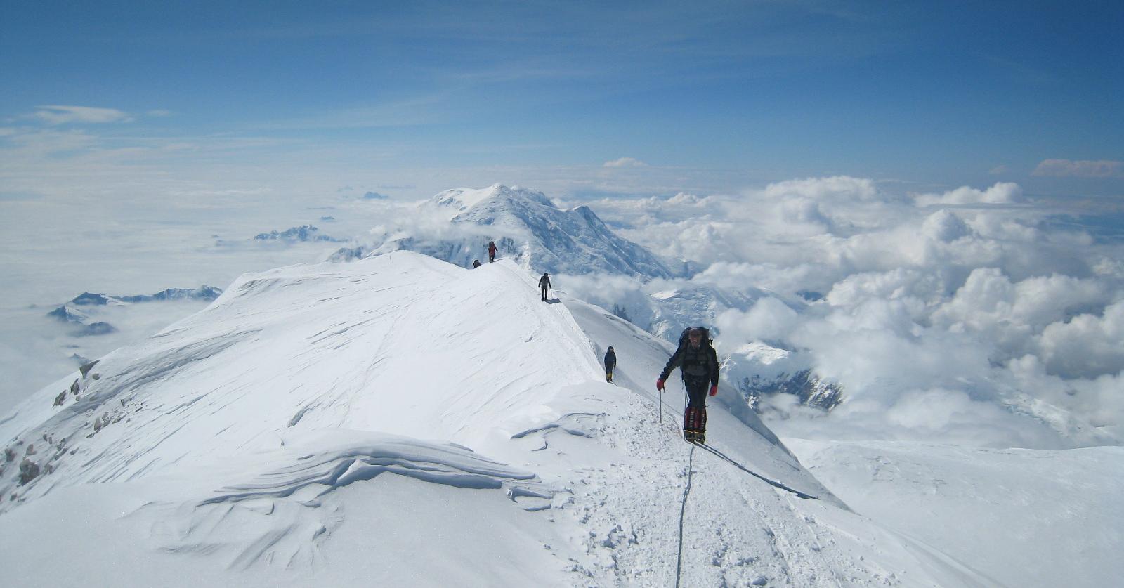
The routes to the peak from the south and south-west ridges are more demanding and the south face climb is considered very difficult.

Before attempting the mountain climbers need to purchase a permit from the Aconcagua Provincial Park authority in Mendoza. Prices vary depending on the season.
The camp sites on the normal route are listed below (altitudes are approximate).
  • Puente del Inca, 2,740m (8,990 ft): A small village on the main road, with facilities including a lodge.
  • Confluencia, 3,380m (11,090 ft): A camp site a few hours into the national park.
  • Plaza de Mulas, 4,370m (14,340 ft): Base camp, claimed to be the second largest in the world (after Everest). There are several meal tents, showers and internet access. There is a lodge approx. 1 km from the main campsite across the glacier.
  • Camp Canadá, 5,050 metres (16,570 ft): A large ledge overlooking Plaza de Mulas.
  • Camp Alaska, 5,200 metres (17,060 ft): Called 'change of slope' in Spanish, a small site as the slope from Plaza de Mulas to Nido de Cóndores lessens. Not commonly used.
  • Nido de Cóndores, 5,570 metres (18,270 ft): A large plateau with beautiful views. There is usually a park ranger camped here.
  • Camp Berlín, 5,940 metres (19,490 ft): The classic high camp, offering reasonable wind protection.
  • Camp Colera, 5,980 metres (19,620 ft): A larger while slightly more exposed camp situated directly at the north ridge near Camp Berlín, with growing popularity.
  • Several sites possible for camping or bivouac, including Piedras Blancas (~6100m) and Independencia (~6350m), exist above Colera, however they are seldom used and offer little protection.
Summit attempts are usually made from a high camp at either Berlín or Colera, or from the lower camp at Nido de Cóndores.

History

The first attempt on Aconcagua by a European was made in 1883 by a party led by the German geologist and explorer Paul Güssfeldt. Bribing porters with the story that there was treasure on the mountain, he approached the mountain via the Rio Volcan, making two attempts on the peak by the north-west ridge and reaching an altitude of 6,500 metres (21,300 ft). The route that he prospected is now the normal route up the mountain.
The first recorded ascent was in 1897 on a British expedition led by Edward FitzGerald. The summit was reached by the Swiss guide Matthias Zurbriggen on January 14 and by two other expedition members a few days later.
The youngest person to reach the summit of Aconcagua was Matthew Moniz of Boulder, Colorado. He was 11 years old when he reached the summit on December 16, 2008. The oldest person to climb it was Scott Lewis who reached the summit on November 26, 2007 when he was 87 years old.


Aconcagua

Aconcagua is the highest mountain in the Americas at 6,962 m (22,841 ft). It is located in the Andes mountain range, in the Argentine province of Mendoza and it lies 112 kilometres (70 mi) west by north of its capital, the city of Mendoza. The summit is also located about 5 kilometres from San Juan Province and 15 kilometres from the international border with Chile. Aconcagua is the highest peak in both the Western and Southern Hemispheres. It is one of the Seven Summits.

Aconcagua is bounded by the Valle de las Vacas to the north and east and the Valle de los Horcones Inferior to the West and South. The mountain and its surroundings are part of the Aconcagua Provincial Park. The mountain has a number of glaciers. The largest glacier is the Ventisquero Horcones Inferior at about 10 km long which descends from the south face to about 3600m altitude near the Confluencia camp. Two other large glacier systems are the Ventisquero de las Vacas Sur and Glaciar Este/Ventisquero Relinchos system at about 5 km long. However the most well-known is the north-eastern or Polish Glacier, a common route of ascent.


The mountain was created by the subduction of the Nazca Plate beneath the South American plate during the geologically recent Andean orogeny; however, it is not a volcano. The origin of the name is contested; it is either from the Arauca Aconca-Hue, which refers to the Aconcagua River and means 'comes from the other side', the Quechua Ackon Cahuak, meaning 'Sentinel of Stone', or Quechua Anco Cahuac, 'White Sentinel'.

Subpeaks and nearby mountains of Mount McKinley (Denali)

Besides the North Summit mentioned above, other less significant features on the massif which are sometimes included as separate peaks are:
  • South Buttress, 15,885 feet (4,842 m); mean prominence = 335 feet (102 m)
  • East Buttress high point, 14,730 feet (4,490 m); mean prominence = 380 feet (116 m)
  • East Buttress, most topographically prominent point, 14,650 feet (4,465 m); mean prominence = 600 feet (183 m)
  • Browne Tower, 14,530 feet (4,429 m); mean prominence = 75 feet (23 m)
None of these peaks are usually regarded as worthwhile objectives in their own right; however they often appear on lists of the highest peaks of the United States.

Nearby important peaks include:
  • Mount Foraker
  • Mount Silverthrone
  • Mount Hunter
  • Mount Huntington
  • Mount Dickey
  • The Moose's Tooth

Weather station of Mount McKinley (Denali)

The Alpine Club installed a meteorological station on a ridge near the summit of Denali at an altitude of 5710 m in 1990. In 1998, this weather station was donated to the International Arctic Research Center at the University of Alaska Fairbanks. In June 2002, a weather station was placed at the 19,000-foot (5,800 m) level. This weather station was designed to transmit data in real-time for use by the climbing public and the science community. Since its establishment, annual upgrades to the equipment have been performed with instrumentation custom built for the extreme weather and altitude conditions. This weather station is one of only two weather stations in the world located above 18,000 feet (5,500 m).

The weather station recorded temperatures as low as −75.5 °F (−59.7 °C) on December 1, 2003. On the previous day, November 30, 2003, a temperature of −74.4 °F (−59.1 °C) combined with a wind speed of 18.4 miles per hour to produce a North American record windchill of −118.1 °F (−83.4 °C).

Even in July, temperatures as low as −22.9 °F (−30.5 °C) and windchills as low as −59.2 °F (−50.7 °C) have been recorded by this weather station.


Climbing history of Mount McKinley (Denali)

The first recorded attempt to climb Mount McKinley was by Judge James Wickersham in 1903, via the Peters Glacier and the North Face, now known as the Wickersham Wall. This route has tremendous avalanche danger and was not successfully climbed until 1963.

Famed explorer Dr. Frederick Cook claimed the first ascent of the mountain in 1906. His claim was regarded with some suspicion from the start, but was also widely believed. It was later proved false, with some crucial evidence provided by Bradford Washburn when he was sketched on a lower peak.


In 1910, four locals (Tom Lloyd, Peter Anderson, Billy Taylor, and Charles McGonagall), known as the Sourdough expedition, attempted McKinley, despite a complete lack of climbing experience. They spent approximately three months on the mountain. However, their purported summit day was impressive: carrying a bag of doughnuts, each a thermos of hot chocolate, and a 14-foot (4.2 m) spruce pole, two of them reached the North Summit, the lower of the two, and erected the pole near the top. According to them, they took a total of 18 hour–a record that has yet to be breached (as of 2006). No one believed their success (partly due to false claims that they had climbed both summits) until the true first ascent, in 1913.

In 1912, the Parker-Browne expedition nearly reached the summit, turning back within just a few hundred yards of it due to harsh weather. In fact, that probably saved their lives, as a powerful earthquake shattered the glacier they ascended hours after they safely left it.

The first ascent of the main summit of McKinley came on June 7, 1913, by a party led by Hudson Stuck. The first man to reach the summit was Walter Harper, an Alaska Native. Harry Karstens and Robert Tatum also made the summit. Tatum later commented, "The view from the top of Mount McKinley is like looking out the windows of Heaven!" They ascended the Muldrow Glacier route pioneered by the earlier expeditions, which is still often climbed today. Stuck confirmed, via binoculars, the presence of a large pole near the North Summit; this report confirmed the Sourdough ascent, and today it is widely believed that the Sourdoughs did succeed on the North Summit. However, the pole was never seen before or since, so there is still some doubt. Stuck also discovered that the Parker-Browne party were only about 200 feet (61 m) of elevation short of the true summit when they turned back.

The mountain is regularly climbed today; in 2003, around 58% of climbers reached the top. But by 2003, the mountain had claimed the lives of nearly 100 mountaineers over time. The vast majority of climbers use the West Buttress Route, pioneered in 1951 by Bradford Washburn, after an extensive aerial photographic analysis of the mountain. Climbers typically take two to four weeks to ascend the mountain.


Timeline

  • 1896–1902: Surveys by Robert Muldrow, George Eldridge, Alfred Brooks.
  • 1903: First attempt, by Judge James Wickersham.
  • 1906: Frederick Cook falsely claims the first ascent of McKinley.
  • 1910: The Sourdoughs ascend the North Summit.
  • 1912: The Parker-Browne attempt almost reaches the South Summit.
  • 1913: First ascent by Hudson Stuck, Walter Harper, Harry Karstens, Robert Tatum.
  • 1932: Second ascent, by Alfred Lindley, Harry Liek, Grant Pearson, Erling Strom. (Both peaks were climbed.)
  • 1947: Barbara Washburn becomes the first woman to reach the summit as her husband Bradford Washburn becomes the first to summit twice.
  • 1951: First ascent of the West Buttress Route, led by Bradford Washburn.
  • 1954: First ascent of the very long South Buttress Route.
  • 1959: First ascent of the West Rib, now a popular, mildly technical route to the summit.
  • 1961: First ascent of the Cassin Ridge, the best-known technical route on the mountain. This was a major landmark in Alaskan climbing.
  • 1963: Two teams make first ascents of two different routes on the Wickersham Wall.
  • 1967: First winter ascent, via the West Buttress, by Dave Johnston, Art Davidson and Ray Genet.
  • 1967: Seven members of Joe Wilcox's twelve-man expedition perish, while stranded for ten days near the summit, in what has been described as the worst storm on record. Up to that time, this was the third worst disaster in mountaineering history in terms of lives lost.
  • 1970: First solo ascent by Naomi Uemura.
  • 1972: Sylvain Saudan, "Skier of the Impossible", skis down the sheer southwest face, conquered for the first time by skier or climber.
  • 1979: First ascent by dog team achieved by Susan Butcher, Ray Genet, Brian Okonek, Joe Redington, Sr., and Robert Stapleton.
  • 1984: Uemura returns to make the first winter solo ascent, but dies after summitting. Tono Križo, František Korl and Blažej Adam from the Slovak Mountaineering Association climb a very direct route to the summit, now known as the Slovak Route, on the south face of the mountain, to the right of the Cassin Ridge.
  • 1988: First solo winter ascent with safe return, by Vern Tejas.
  • 1997: First successful ascent up the West Fork of Traleika Glacier up to Karstens Ridge beneath Browne Tower. This path was named the "Butte Direct" by the two climbers Jim Wilson and Jim Blow.


History of Mount McKinley (Denali)

The Koyukon Athabaskans are the first Native Americans with access to the flanks of
the mountain (living in the Yukon, Tanana and Kuskokwim basins). The historical first European sighting of Mount McKinley took place on May 6, 1794, when George Vancouver was surveying the Knik Arm of the Cook Inlet and mentioned “distant stupendous mountains” in his journal. The Russian explorer Lavrenty Zagoskin explored the Tanana and Kuskokwim rivers in 1843 and 1844 and was probably the first European to sight the mountain from the other side.

William Dickey, a New Hampshire-born Seattleite who had been digging for gold in the sands of the Susitna River, wrote, after his return to the lower states, an account in the New York Sun that appeared on January 24, 1897. His report drew attention with the sentence “We have no doubt that this peak is the highest in North America, and estimate that it is over 20,000 feet (6,100 m) high.” Until then 18,000-foot (5,500 m) Mount Saint Elias was believed to be the continent’s highest point (Mount Logan was still unknown and Mount St Elias’ height had been overestimated to beat Pico de Orizaba[citation needed]). Though later praised for his estimate, Dickey admitted that other prospector parties had also guessed the mountain to be over 20,000 feet (6,100 m).


Naming of Mount McKinley (Denali)

The Koyukon Athabaskan people who inhabit the area around the mountain referred to the peak as Dinale or Denali ("the high one" or "the great one"). In the late 1890s, a gold prospector named it "McKinley" as political support for then-president William McKinley. The Alaska Board of Geographic Names changed the name of the mountain to Denali, which is how it is referred to locally. However, a 1975 request by the Alaska state legislature to the United States Board on Geographic Names to do the same was blocked by Ohio congressman Ralph Regula, whose district includes McKinley's hometown. Members of the Ohio congressional delegation continue to protect the McKinley name, blocking attempts by the Alaska congressional delegation to get the Board of Geographic Names to change it to Denali. Thus, "Denali" is correct according to the Alaska state Board, while "McKinley" is correct according to the national Board.

Mount McKinley (Denali)

Mount McKinley or Denali (Koyukon Athabaskan for "The High One", Dghelaayce’e in Ahtna) in Alaska, United States is the highest mountain peak in North America and the United States, with a summit elevation of 20,320 feet (6,194 m) above sea level. The CIA World Factbook lists its summit elevation as 6,198 metres (20,335 ft). It is the centerpiece of Denali National Park and Preserve.

Geology and features

Mount McKinley is a granitic pluton. It has been uplifted by tectonic pressure while at the same time, erosion has stripped away the (somewhat softer) sedimentary rock above and around the mountain.

The forces that lifted Mount McKinley—the subduction of the Pacific plate beneath the North American plate—also raised great ranges across southern Alaska. As that huge sheet of ocean-floor rock plunges downward into the mantle, it shoves and crumples the continent into soaring mountains which include some of the most active volcanoes on the continent. Mount McKinley in particular is uplifted relative to the rocks around it because it is at the intersection of major active strike-slip faults (faults that move rocks laterally across the Earth's surface) which allow the deep buried rocks to be unroofed more rapidly compared to those around them.


Layout of the mountain

Mount McKinley has two significant summits: the South Summit is the higher one, while the North Summit has an elevation of 19,470 feet (5,934 m) and a prominence of approximately 1,320 feet (402 m). The North Summit is sometimes counted as a separate peak (see e.g., the List of United States fourteeners) and sometimes not; it is rarely climbed, except by those doing routes on the north side of the massif.

Five large glaciers flow off the slopes of the mountain. The Peters Glacier lies on the northwest side of the massif, while the Muldrow Glacier falls from its northeast slopes. Just to the east of the Muldrow, and abutting the eastern side of the massif, is the Traleika Glacier. The Ruth Glacier lies to the southeast of the mountain, and the Kahiltna Glacier leads up to the southwest side of the mountain.

Notable features

Mount McKinley has a larger bulk and rise than Mount Everest, although the summit of Everest is higher at 29,029 feet (8,848 m). Everest's base sits on the Tibetan Plateau at about 17,000 feet (5,200 m), giving it a real vertical rise of little more than 12,000 feet (3,700 m). The base of Mount McKinley is roughly at 2,000-foot (610 m) elevation, giving it an actual rise of 18,000 feet (5,500 m). The mountain is also characterized by extremely cold weather. Temperatures as low as −75.5 °F (−59.7 °C) and windchills as low as −118.1 °F (−83.4 °C) have been recorded by an automated weather station located at 18,700 feet (5,700 m). According to the National Park Service, in 1932 the Liek-Lindley expedition recovered a self-recording minimum thermometer left near Browne's Tower, at about 15,000 feet (4,600 m), on Mount McKinley by the Stuck-Karstens party in 1913. The spirit thermometer was calibrated down to 95 °F below zero and the lowest recorded temperature was below that point. Harry J. Liek took the thermometer back to Washington, D.C. where it was tested by the United States Weather Bureau and found to be accurate. The lowest temperature that it had recorded was found to be approximately −100 °F (−73 °C).

Sunday, June 19, 2011

Climbing routes Of Mount Elbrus

The Normal Route is the easiest, safest and fastest on account of the cable car and chairlift system which operates from about 9am till 3pm. Starting for the summit at about 2am from the Diesel Hut should allow just enough time to get back down to the chairlift if movement is efficient. A longer ascent Kiukurtliu Route starts from below the cable-way Mir station and heads west over glacier slopes towards the Khotiutau pass.

Climbing Elbrus from other directions is a tougher proposition because of lack of permanent high facilities. Douglas Freshfield always maintained that a route from the east up the Iryk valley, Irykchat glacier and over the Irykchat pass (3667m) on to snowfields below long rock ribs of the east spur would become the shortest and most used approach.


Three permits are required for climbing. Foreigners need a Border Zone Permit to be in any area south of Baksan. Prielbrusie National Park Permit is required for access to the park. Foreigners also must be registered in OVIR (Visa and Registration department) in Tyrnyauz.

History Of Mount Elbrus

The ancients knew the mountain as Strobilus, Latin for 'pine cone', a direct loan from the ancient Greek strobilos, meaning 'a twisted object' – a long established botanical term that describes the shape of the volcano's summit. Myth held that here Zeus had chained Prometheus, the Titan who had stolen fire from the gods and given it to ancient man – likely a reference to historic volcanic activity.

The lower of the two summits was first ascended on 10 July 1829 (Julian calendar) by Khillar Khachirov, a Karachay[9] guide for an Imperial Russian army scientific expedition led by General Emmanuel, and the higher (by about 40 m—130 ft) in 1874 by an English expedition led by F. Crauford Grove and including Frederick Gardner, Horace Walker, and Swiss climber Peter Knubel. During the early years of the Soviet Union, mountaineering became a popular sport of the masses, and there was tremendous traffic on the mountain. In the winter of 1936, a very large group of inexperienced Komsomol members attempted the mountain, and ended up suffering many fatalities when they slipped on the ice and fell to their deaths. The Wehrmacht occupied the area surrounding the mountain from August 1942 to January 1943, during World War II, with 10,000 soldiers of a Gebirgsjäger (Mountain Troop) division. A possibly apocryphal story tells of a Soviet pilot being given a medal for bombing the main mountaineering hut, Priyut 11, while it was occupied. He was then later nominated for a medal for not hitting the hut, but instead the German fuel supply, leaving the hut standing for future generations. When news reached Adolf Hitler that a detachment of mountaineers was sent by the general officer commanding the German division to climb to the summit of Elbrus and plant the swastika flag at its top, he reportedly flew into a rage, called the achievement a "stunt" and threatened to court martial the general.


The Soviet Union encouraged ascents of Elbrus, and in 1956 it was climbed en masse by 400 mountaineers to mark the 400th anniversary of the incorporation of Kabardino-Balkaria, the Autonomous Soviet Socialist Republic where Elbrus was located.

From 1959 through 1976, a cable car system was built in stages that can take visitors as high as 3,800 metres (12,500 ft). There is a wide variety of routes up the mountain, but the normal route, which is free of crevasses, continues more or less straight up the slope from the end of the cable car system. During the summer, it is not uncommon for 100 people to be attempting the summit via this route each day. Winter ascents are rare, and are usually undertaken only by very experienced climbers. Elbrus is notorious for its brutal winter weather, and summit attempts are few and far between. The climb is not technically difficult, but it is physically arduous because of the elevations and the frequent strong winds. The average annual death toll on Elbrus is 15–30, primarily due to "many unorganized and poorly equipped" attempts to summit the mountain.

Mount Elbrus should not be confused with the Alborz (also called Elburz) mountains in Iran, which also derive their name from the legendary mountain Harā Bərəzaitī in Persian mythology.

In 1997, a Land Rover Defender was driven to the summit, breaking into the Guinness Book of Records.

Geographical Setting and eruptive history


Elbrus stands 20 km (12 mi) north of the main range of the Greater Caucasus and 65 km (40 miles) south-southwest of the Russian town of Kislovodsk. Its permanent icecap feeds 22 glaciers, which in turn give rise to the Baksan, Kuban, and Malka Rivers.

Elbrus sits on a moving tectonic area, and has been linked to a fault. Apparently, Elbrus has a "deep" supply of magma that resides underneath it.


The volcano is currently considered inactive, as no eruptions have ever been recorded. Still Elbrus was active in the Holocene. According to the Global Volcanism Program the last eruption took place between 0 and 100 AD. Evidence of recent volcanism includes several lava flows on the mountain, which look fresh, and roughly 260 square kilometres (100 sq mi) of volcanic debris. The longest flow extends 24 kilometres (15 mi) down the northeast summit, indicative of a large eruption. There are still more various signs of activity still present on the volcano, including solfataric activity and hot springs. The western summit has a well preserved volcanic crater about 250 m in diameter.

Mount Elbrus

Mount Elbrus  is an inactive volcano located in the western Caucasus mountain range, in Kabardino-Balkaria and Karachay-Cherkessia, Russia, near the border of Georgia. Mt. Elbrus's highest peak is the highest mountain in the Caucasus, in Russia. While there are differing authorities on how the Caucasus are distributed between Europe and Asia, many sources agree that Elbrus is also the highest mountain in all of Europe. Mt. Elbrus (west summit) stands at 5,642 metres (18,510 ft); the east summit is slightly lower at 5,621 metres (18,442 ft).


Etymology

The name Elbrus is a metathesis of Alborz. The name Alborz is derived from that of Harā Bərəzaitī, a legendary mountain in Persian mythology. Harā Bərəzaitī reflects Proto-Iranian Harā Bṛzatī. Bṛzatī is the feminine form of the adjective bṛzant—"high", the reconstructed ancestor of modern Persian boland and Barz/Berazandeh. Harā may be interpreted as "watch" or "guard", from an Indo-European root ser—"protect". In Middle Persian, Harā Bərəzaitī became Harborz, Modern Persian Alborz, which is cognate with Elbrus.

Other names

  • Mingi Taw  – a Karachay–Balkar (Turkic). Mingi Taw means an eternal mountain or Thousand Mountain.
  • Jin-Padishah  – a Turkic name of Perso-Arabic origin
  • Yalbuz  – ice mane (Turkic)
  • Ialbuzi  – (Georgian)
  • Oshkhamakhua  – the mount of happiness (Circassian)


Geology, Access, Glaciers and climbing Of Puncak Jaya

Puncak Jaya is the highest point on the central range, which was created in the late Miocene Melanesian orogeny, caused by oblique collision between the Australian and Pacific plates and is made of middle Miocene limestones.

Access to the peak requires a government permit. The mountain was closed to tourists and climbers between 1995 and 2005. As of 2006, access is possible through various adventure tourism agencies.


While Puncak Jaya’s peak is free of ice, there are several glaciers on its slopes, including the Carstensz Glacier and the Northwall Firn. Being equatorial, there is little variation in the mean temperature during the year (around 0.5°C) and the glaciers fluctuate on a seasonal basis only slightly. However, analysis of the extent of these rare equatorial glaciers from historical records show significant retreat since the 1850s, around the time of the Little Ice Age Maximum which primarily affected the Northern Hemisphere, indicating a regional warming of around 0.6°C per century between 1850 and 1972.


The glacier on Puncak Trikora in the Maoke Mountains disappeared completely some time between 1939 and 1962. Since the 1970s, evidence from satellite imagery indicates the Puncak Jaya glaciers have been retreating rapidly. The Meren Glacier melted away sometime between 1994 and 2000. An expedition led by paleoclimatologist Lonnie Thompson in 2010 found that the glaciers are receding at a rate of seven meters per year and will disappear in four to five years.


Puncak Jaya is one of the more demanding climbs in one version of the Seven Summits peak-bagging list. (It is replaced by Mount Kosciuszko in the other version.) It is held to have the highest technical rating, though not the greatest physical demands of that list's ascents. The standard route is up the north face and along the summit ridge, which is all hard rock surface. Despite the large mine, the area is highly inaccessible to hikers and the general public, requiring a 100-km hike from the nearest town with an airport, Timika, to the base camp, which usually takes about four or five days each way.


History Of Puncak Jaya

The highlands surrounding the peak were inhabited before European contact, and the peak was known as Nemangkawi in Amungkal. Puncak Jaya was named "Carstensz Pyramid" after Dutch explorer Jan Carstenszoon who first sighted the glaciers on the peak of the mountain on a rare clear day in 1623. The sighting went unverified for over two centuries, and Carstensz was ridiculed in Europe when he said he had seen snow near the equator. This name is still used among mountaineers. Although the snowfield of Puncak Jaya was reached as early as 1909 by a Dutch explorer, Hendrik Albert Lorentz with six of his indigenous Dayak Kenyah porters recruited from the Apo Kayan in Borneo, the peak was not climbed until 1962, by an expedition led by the Austrian mountaineer Heinrich Harrer (of Seven Years in Tibet fame, and climber of the Eiger North Face) with three other expedition members – Philip Temple, Russell Kippax and Bert Huizenga. Temple, from New Zealand, had previously led an expedition into the area and pioneered the access route to the mountains.


When Indonesia took control of the province in the 1960s, the peak was renamed 'Puntjak Soekarno' (Simplified Indonesian: Puncak Sukarno) or Sukarno Peak, after the first President of Indonesia; later this was changed to Puncak Jaya. Puncak means peak or mountain and Jaya means 'victory', 'victorious' or 'glorious'.

Carstensz Pyramid (Puncak Jaya)


Puncak Jaya, sometimes called Mount Carstensz or the Carstensz Pyramid (/ˈkɑrstənz/), is a mountain in the Sudirman Range, the western central highlands of Papua province, Indonesia (within Puncak Jaya Regency). Other names include Nemangkawi in the Amungkal language, Ngga Pulu, Carstensz Toppen and Gunung Sukarno.


At 4,884 metres (16,024 ft) above sea level, Puncak Jaya is the highest mountain in Indonesia, the highest on the island of New Guinea (which comprises the Indonesian Papua provinces plus Papua New Guinea), the highest of Oceania (Australia), and the 5th highest mountain in political Southeast Asia. It is also the highest point between the Himalayas and the Andes, and the highest island peak in the world. Some sources claim Mount Wilhelm, 4,509 m (14,793 ft), as the highest mountain peak in Oceania, on account of Indonesia being part of Asia (Southeast Asia).

Friday, June 17, 2011

History Of Vinson Massif


A high mountain, provisionally known as 'Vinson', was long suspected to be in this part of West Antarctica, but it was not actually seen until January 1958, when it was spotted by US Navy aircraft from Byrd Station. It was named after Carl Vinson (also the namesake of an aircraft carrier), a United States Georgia Congressman who was a key supporter of funding for Antarctic research. The first measurement of the Vinson Massif was established in 1959 at the elevation of 5,140 m (16,864 ft).


First ascent

In 1963, two groups within the American Alpine Club, one led by Charles Hollister and Samuel C. Silverstein, M.D., then in New York, and the other led by Peter Schoening of Seattle, Washington, began lobbying the National Science Foundation to support an expedition to climb . The two groups merged in spring 1966 at the urging of the National Science Foundation and the American Alpine Club, and Nicholas Clinch (Pasadena, CA) was recruited by the American Alpine Club to lead the merged expeditions. Named officially the American Antarctic Mountaineering Expedition 1966/67, the expedition was sponsored by the American Alpine Club and the National Geographic Society, and supported in the field by the U.S. Navy and the National Science Foundation Office of Antarctic Programs. Ten scientists and mountaineers participated in AAME 1966/67. In addition to Clinch they were Barry Corbet (Jackson Hole, WY), John Evans (University of Minnesota, Minneapolis, MN), Eiichi Fukushima (University of Washington, Seattle, WA), Charles Hollister, Ph.D. (Columbia University, New York, NY), William Long, Ph.D. (Alaska Methodist University, Anchorage, AK), Brian Marts (Seattle, WA), Peter Schoening (Seattle, WA), Samuel Silverstein, M.D. (Rockefeller University, New York, NY) and Richard Wahlstrom (Seattle, WA).

In the months prior to its departure for Antarctica the expedition received considerable press attention, primarily because of the reports that Woodrow Wilson Sayre was planning to fly in a Piper Apache piloted by Max Conrad, the "flying Grandfather", with four companions into the Sentinel Range to climb the Vinson Massif. Sayre had a reputation for problematic trips as a result of his unauthorized, unsuccessful, and nearly fatal attempt to climb Mount Everest from the North in 1962. His unauthorized incursion into Tibet led China to file an official protest with the U.S. State Department. In the end, the purported race did not materialize as Conrad had difficulties with his plane. According to press reports, he and Sayre were still in Buenos Aires on the day the first four members of AAME 1966/67 reached Vinson's summit.


In December 1966 the Navy transported the expedition and its supplies from Christchurch, New Zealand to the U.S. base at McMurdo Sound, Antarctica, and from there in a ski-equipped C-130 Hercules to the Sentinel Range. All members of the expedition reached the summit of the Vinson Massif. The first group of four climbers summited on December 18, 1966, four more on December 19, and the last three on December 20.

On August 18, 2006, from nomination by Damien Gildea of the Omega Foundation, US-ACAN approved naming the subsidiary peaks south of Mt. Vinson for the AAME 1966/67 members Nicholas Clinch, Barry Corbet, Eiichi Fukushima, Charles Hollister, Brian Marts, Samuel Silverstein, Peter Schoening and Richard Wahlstrom. Other peaks in the Sentinel Range had previously been named for John Evans and William Long.


Later ascent

The climb of Vinson offers little technical difficulty beyond the usual hazards of travel in Antarctica, and as one of the Seven Summits, it has received much attention from well-funded climbers in recent years. As of 2010, nearly 2000 people have summited Mount Vinson.

First ascent from east side

While the vast majority of prior climbs to the summit have used the western side of the massif from the Branscomb Glacier, the first ascent from the east side was successfully completed by an eight-person team sponsored by NOVA in January 2001. The team consisted of:
  • Conrad Anker - expedition leader
  • Jon Krakauer - mountaineer and author
  • Dave Hahn - mountain guide with 27 ascents, including ascents to Gardner, and Shinn.
  • Andrew Mclean - extreme skier
  • Dan Stone - glaciologist
  • Lisel Clark - producer
  • John Armstrong - cameraman
  • Rob Raker - assistant cameraman and sound recording
The team not only made the first ascent from the east side but also performed scientific research into snow accumulation at different elevations as well as taking the first ground based GPS reading from the summit. The GPS reading gave the elevation of the highest point in Antarctica as 16,077 ft (4,900 m), eclipsing the earlier established heights recorded in 1959 and 1979.
Another first was the successful aircraft landing of a Twin Otter on the Upper Dater Glacier on the eastern slopes of Vinson Massif.
NOVA named the production "Mountain of Ice", which first aired on PBS in February 2003.


Climate and glaciers Of Vinson Massif


The climate on Vinson is generally controlled by the polar ice cap's high-pressure system, creating predominantly stable conditions but, as in any arctic climate, high winds and snowfall are a possibility. Though the annual snowfall on Vinson is low, high winds can cause base camp accumulations up to 46 centimetres (18 in) in a year. During the summer season, November through January, there are 24 hours of sunlight. While the average temperature during these months is −30 °C (−20 °F), the intense sun will melt snow on dark objects.


Over successive years, the limited amount of snow that falls on Vinson Massif compacts and is transformed into ice, forming glaciers. These glaciers follow the topography and flow down the mountains valleys. The uppermost glacier occupies the north face of Vinson, and flows either into Branscomb Glacier to the west or Crosswell Glacier to the east. The Crosswell Glacier flows into the Rutford Ice Stream via Ellen Glacier.

 
Design by | Bloggerized by World Mountain - Premium Blogger Themes | Blogger Templates